Re: temperature readings on my 530 that I posted above… If I pull temps along the course, as reported by normal people using $100 weather stations and uploading to WeatherUnderground, I don’t see a problem when riding in the late afternoon.
The only time I see a discrepancy is late morning and afternoon when the sun is overhead, and only in the summer when its hot. I’ve definitely seen stuff like Garmin 530 records 94 degrees and actual air temperature is around 85.
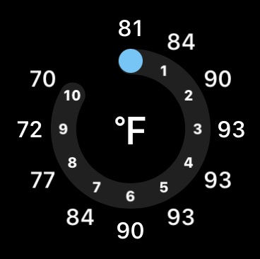
Once outside later today, depending on the wind it might be slightly warmer or cooler. While on the bike I might raise my wrist and look at my watch, but it doesn’t always completely agree with my phone:
My wife will sometimes ask about temps (“should I bring a sweater?”) before we head out the door at say 5pm, and 2 phone apps will not completely agree on the forecasted temp at 8pm.
Regardless, there is nothing actionable once I’m outside on the bike. If the heat is getting to me, it doesn’t matter if my Garmin says 100F while my phone says 95F. I listen to my body and do what’s necessary.
And if it feels like mid 80s and the Garmin shows 95F, its because the sun is overhead and back to FatBoySlim and my point that you are better off glancing at phone/watch app, or using a ConnectIQ app.
I agree, it is amazing. But the weather stations might be miles from where you’re riding, or you might be in and out of shaded areas, or you might get rain and a sudden temperature drop, or you might just have $30 to spend.
Well… the app uses your phone that has gps on it. Accurate just like whatever weather program is on your phone.
If I am in and out of shaded areas I will be able to tell if its warmer or colder, really dont see how an accurate temperature will help me! I dont need accurate temperature if it rains and the temperature drops as I will know if I am cold and wet. The temperature on the screen is not going to make me feel better about being cold and wet!!!
Windfield will forcast the next few hours of weather on the edge so you can prepare for it in advance. I dont really care if the temperature is 100F or 30C on the edge and a tornado warning is out and a huge storm is 1-3 hours away. The edge temperature tells me nothing. Windfield tells me the future. ;).
I experienced the tornado warning and the massive storms in June. On my trip I missed almost all the storms (except one as I thought it would go north of me). I also found safety far in advance of both Tornado issues.
I’m wondering about the increase in crashes from those who use this outside in a sound system that blocks external noise. Hoping people realize there are options like bone conduction headphones that work great on the bike. I use aeropex from aftershox
On the HWY 50 side most people use Mormon Immigrant to get up to Hwy 88 to get to South Lake Tahoe. I think there may be a way to be able to get to north shore on paved roads, but I’m not sure what that would be. It is definitely gravel on Foresthill all the way to where it comes out near Soda Springs at the Serene Lakes community. That is a very remote area, and the road is quite rough, and it takes a LONG time to get there.
Well, I joined the 1040 club after I took an endo on my MTB a week ago and broke the mounting point of my 1030. Started getting it set up this morning, and need to figure out power plan, climb pro, all of that.
Does anyone have any idea how to create a route for a race that does 4 laps of the same course? Been playing around with editing the GPX manually, but have never tested this, anyone done it? Easier way?
Well, I was able to edit the GPX to create the multiple laps, but I think I need to do a test close to the house to make sure navigating multiple laps works in practice. Wouldn’t want to get to the end of lap 1 and just have it assume I crossed the finish line and end navigation…
Changes made from version 14.12 to 14.13:
Updated to Training Status 2.0
Fixed issue with Di2/Remote actions going to previous page
Fixed Connect IQ issue with getting temperature data
Fixed changing data fields on workout data screen
Fixed auto lap by position
Fixed issues with ebike range
Made minor improvement to power calibration UI
Fixed various bugs and improved product stability
Anyone know what the different version of training status really means?
I believe its the same as back on the 1030. I used the course that was provided and added it to the courses on the 1030. I then loaded the course in the 1030. I pressed start at the start line and then every time I went through the start line it started a new lap. I did not have to do anything to the course.
I don’t understand why the 1040 firmware is so unstable given that with the exception of the GPS chip it is a 1030+. This either means that Garmin tried to rewrite a significant port of the 1030+ firmware, the Garmin code base is basically a disaster, or some combination of the two. Which doesn’t bode well for the future.
This feels like Garmin is in the Microsoft Windows trap: an ancient code base that they’ve been just layer new functionality on top of that desperately needs a clean start.
Have you ever written an embedded OS that supports apps and long battery life? I’ve been in this part of the engineering world for 30 years. FWIW my 530 wasn’t unstable. A few quirks but no show stoppers.
Sorry its not working for you. I love it. Rode a 1660 km one way trip with it in June across 4 provinces. Not one issue. Had garmin varia 510, garmin rally pedals and a viiiiva heart rate monitor. No issues at all. Just upgraded to the latest beta. On Saturday I start a 500 km backcountry race in the rocky mountains. Only difference is that this time I will have a garmin inreach connected to the 1040. I am hoping everything goes well as I will not have cell service for about 300 km of the race. But I do have rwgps on my phone with the course downloaded just in case.
Makes sense it would work that way, but then seems like Power Plan functionality wouldn’t work? (Never actually tried a multi-lap course on my 1030)
Building up a new bike this weekend and then am going to test near the house. I’ll run multiple laps of a course that’s just one loop, and then I’ll set up the course to actually include the multiple laps and see what happens.