Yesterday was a “hike” in the mountains. Really, though, it was playing “bows and arrows” in a forest just over an hour away, traversing the Brünig pass that I should do before I leave here. The 3D archery tournament had some great views when we weren’t in the forest.
Not having touched my bow in about 4 weeks, and then only about 3-4 times in the several months prior, I shot well at 22 or so of the 27 targets, but I whiffed three and almost whiffed two others, which made for a poor placement. But there was chäsbrätel (melted local cheese on thick bread… don’t call it an open-faced grilled cheese equivalent).
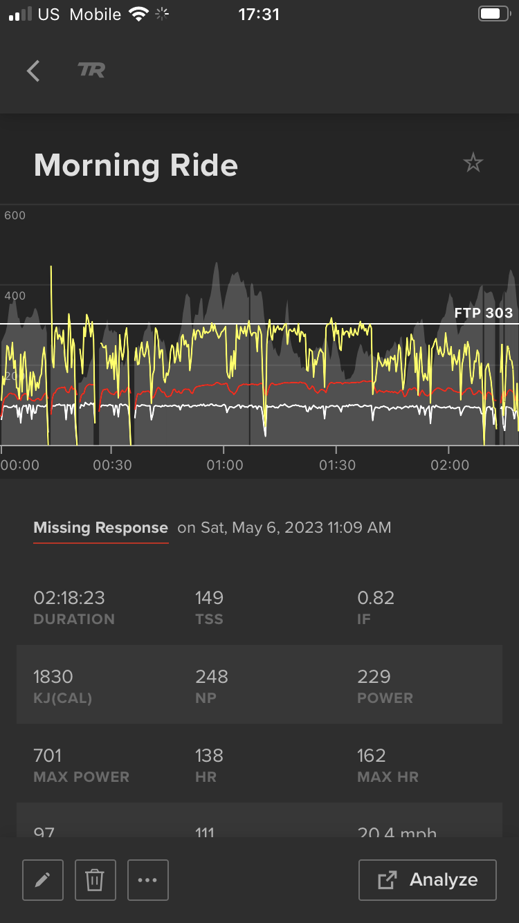
Today was to be a 65-mile-ish road ride. I thought I could beat the weather at the target mountain, but I wasn’t so sure. For a local ride, it’s not bad. The planned route today would have 7400’, but I cheated and took out a local descent and thus ascent by staying on local roads instead of dropping to the lake.
The views weren’t bad, but the clouds were dark over the destination area.
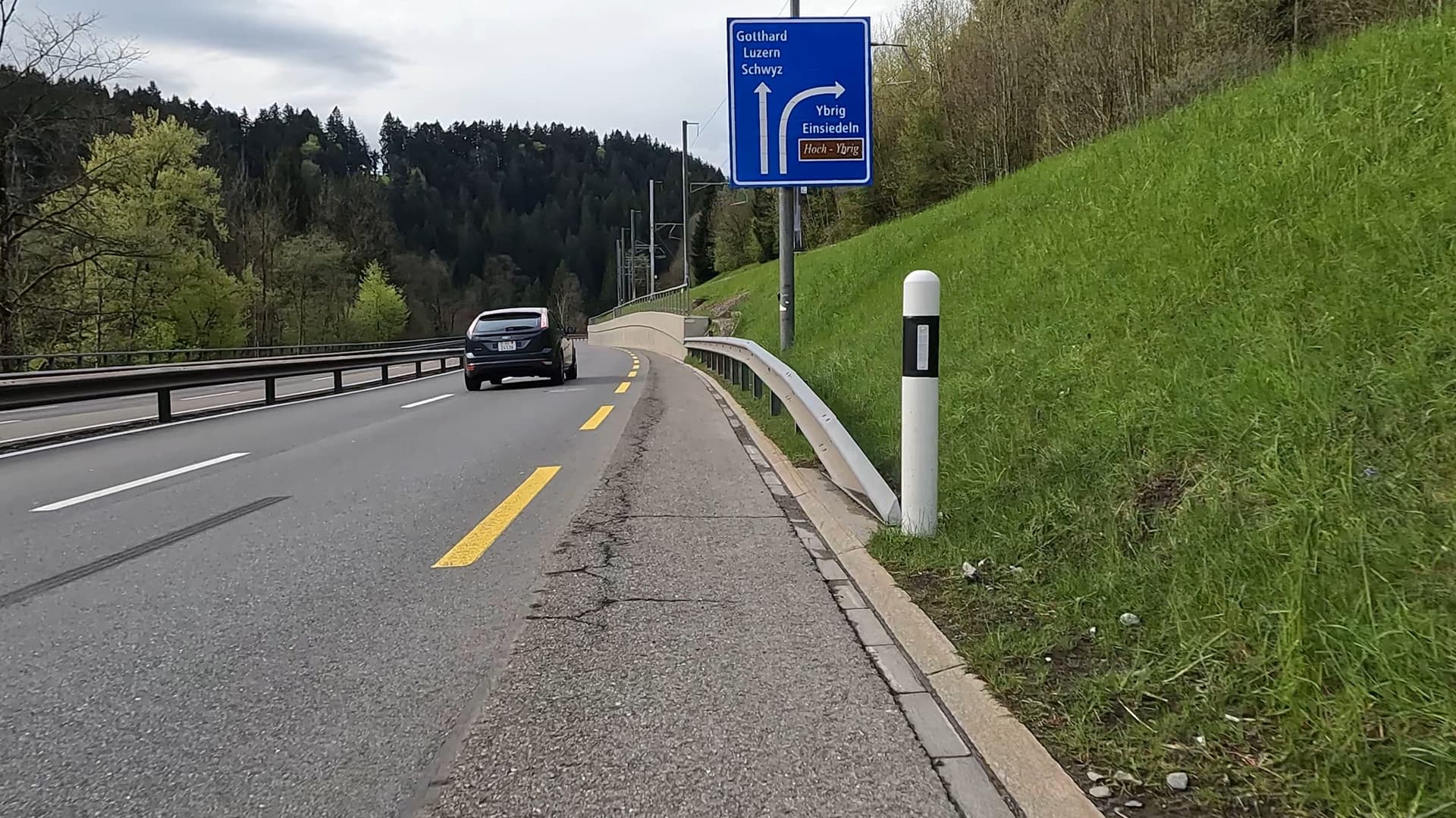
Some highway time to get there, which is fine.
By this time, I’ve detoured off my intended route because the sky isn’t looking good. Below, setting aside looking like a model train set, an alternate route with a good climb also doesn’t look good. The climbing in the rain is fine, it’s the steep, narrow descent with two-way traffic and not a lot of space for a bike. In dry weather, no problem, in wet with wind (there was also a thunderstorm warning), yeah, pass…
So I continued… pausing to see the jump.
And a little gravel time for more cow bell. There was a lot of cow bell and a fair amount of goat bell today. Again, the pics don’t convey how ominous the clouds were. While this wasn’t my route, the other side of the peaks is where my options A and B would take me.
A minute after the pic, I turned left to get back to the road and turned left again, at which time it started to rain large drops. Since I was minutes away, I went up the cobbles in the rain for a pic at the
Benedictine Einsiedeln Abbey, established in the 10th century. It doesn’t really look wet, but I was slow on the descent back down the road on the cobbles.
Should be fast down this, actually, I shouldn’t be going this way as it was how I came up (the model trainset pic, taken on the ascent, was taken a short distance further from here), but I decided my route here was the flattest option to get out of the rain.
Returning via the highway on freshly wet roads wasn’t the plan, but it was the only way to avoid steep downhills.
Getting back to my general region and it is warm, sunny, and not a drop of water proving that if you don’t like the weather here, go to the next valley or canton and maybe it’ll be different.
There are opportunities to go fast on this local road, which, back when I was getting out for more road rides at lunch, was part of one of my 60-75 min quickies (not the same as the hill quickie route). But it is two-way traffic and sometimes there’s a village tucked in close to the road to make squeeze points.
In the end, it was only 38 miles with a veritably flat 3100’. It was probably for the best because I really am not ready for what I intended to do today.
Where was I and where did I intend to go? Option A was to the right (looking at the map, or east of) of Einsiedeln and over the far mountains seen from the gravel pics, with option B to the left (looking at the map, or west of) the valley I was in. Oh well, another day.


")